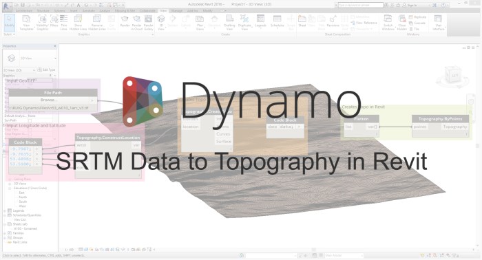
Overview: This workflow allows the user to source SRTM Data in GeoTIFF format from http://earthexplorer.usgs.gov/, and use it to create topography in Revit. Shuttle Radar Topography Mission (SRTM), was carried out by Nasa in 2000 and recorded elevation data. This data has been made available globally at 1 Arc Second, and in more detail at 1/3 Arc Second for some parts of the US.
Packages: ‘Elk’.
Download Script: Dropbox link
Step 1: Getting your SRTM Data in GeoTIFF format
Go to http://earthexplorer.usgs.gov/ and login, or register for a free account.
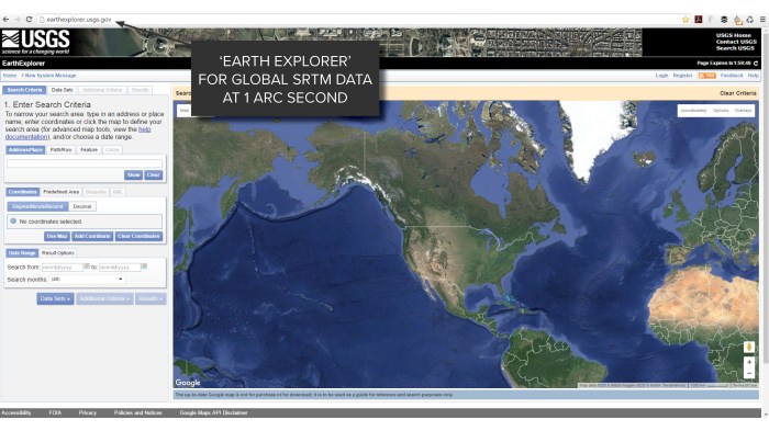
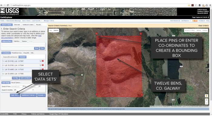
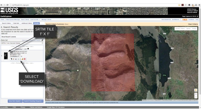
Zoom to your desired location, and place pins or enter co-ordinates to create a bounding box. Then select ‘Data Sets’.
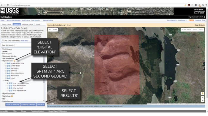
Next, you should navigate to ‘Digital Elevation’ > ‘SRTM’, and select ‘SRTM 1 Arc-Second Global’ before clicking ‘Results’.
The ‘Result’ should be a 1° x 1° tile. If your bounding box spans multiple tiles, you will be given the option to download 2 or more images. These can be stitched together at a later stage. Next click the ‘Download’ icon.
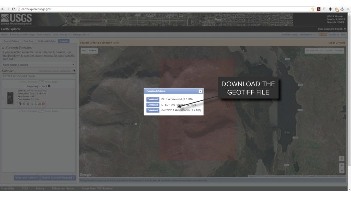
From the pop-up window, download the ‘GeoTIFF 1 Arc-second’. This file will be used to create your topography in Dynamo and Revit.
Step 2: Creating your topography in Dynamo and Revit
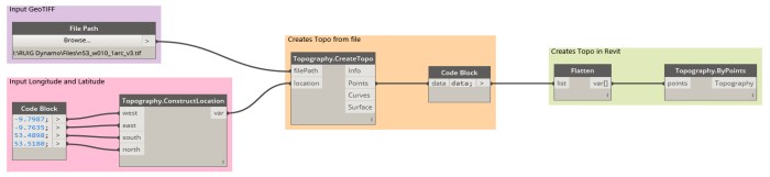
First open Dynamo from Revit and then the script. Use the ‘File Path’ node to select your downloaded GeoTIFF file, and input the decimal co-ordinates of your selected location. If you don’t already have these they are available from the Earth Explorer website after you’ve created your bounding box.
NOTE: If you’re also using OSM data this can be used as your location.
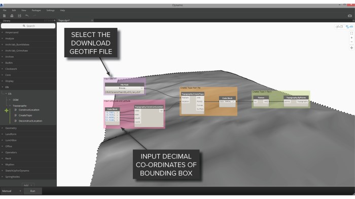
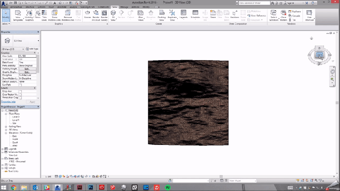
Click ‘Run’, and just wait a little bit for it to work its magic and we’re done! You can now close Dynamo and head back to Revit. The result looks a little bit like this..
Hope it’s of some help! I can’t imagine it’s very accurate, but a good place to start.
Credit to Timothy Logan for his ‘Elk’ nodes and video tutorials!
Rene Pellicer Garcia also put together a nice video tutorial here..

this seems to work fine as per the steps, but i tried the highest mountain in ireland, and it still results in a relatively flat surface. something isnt working correctly.
I think the trouble lies with the quality of the SRTM Data. When you go outside the US the data isn’t as accurate i.e. at 1 Arc Second Global it’s only a digital elevation point every 30 metres. You can get lucky though, and it can be handy while waiting on a survey to come in.
What if under SRTM there is no ‘SRTM 1 Arc-Second Global’?
What if under STRM there is no ‘SRTM 1 Arc-Second Global’?
i had soem probleme with opography create topo node, first it worked but now i t give me error message such as eexception was raised by the type initializer for OSGeo.GDAL.GdalPINVOKE !! any help pls?