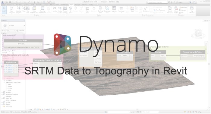
Overview: This workflow allows the user to source SRTM Data in GeoTIFF format from http://earthexplorer.usgs.gov/, and use it to create topography in Revit. Shuttle Radar Topography Mission (SRTM), was carried out by Nasa in 2000 and recorded elevation data. This data has been made available globally at 1 Arc Second, and in more detail at 1/3 Arc Second for some parts of the US.
Packages: ‘Elk’.
Download Script: Dropbox link